Real-World Data · Interactive 3D Mapping · Spatial Visualization Experiments
An ongoing series of hands-on geospatial experiments exploring how real-world spatial data, interactive mapping technologies, and dynamic visualization techniques can be combined to create richer geographic experiences.
Built primarily with CesiumJS, these experiments investigate everything from satellite orbits and live aircraft tracking to animated street traffic and community-sourced ground imagery.
The work serves as a practical research and prototyping environment for Noah Link, an emerging geospatial operations platform. Individual experiments help evaluate technical approaches, rendering performance, data integration, and interaction models before capabilities are incorporated into the broader application.
The following screenshots represent working experimental implementations rather than conceptual designs.
01
Global Satellite Tracking
Orbital Data · Position Propagation · 3D Visualization
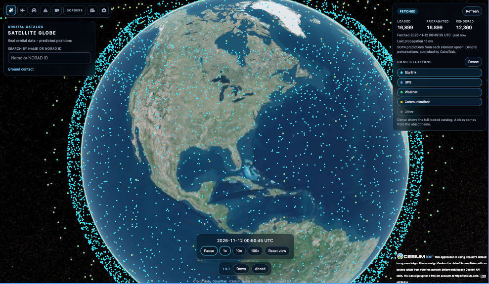
An interactive 3D globe visualizing thousands of satellites and orbital objects using publicly available orbital data. Satellite positions are calculated through orbital propagation, allowing exploration of constellation distributions, object classifications, and changing orbital positions over time.
The experiment explores efficient rendering of large spatial datasets, time-dependent visualization, and the foundations of satellite-focused geospatial operations.
02
Live Aircraft Tracking
Real-Time Positioning · Flight Data · Immersive Perspectives
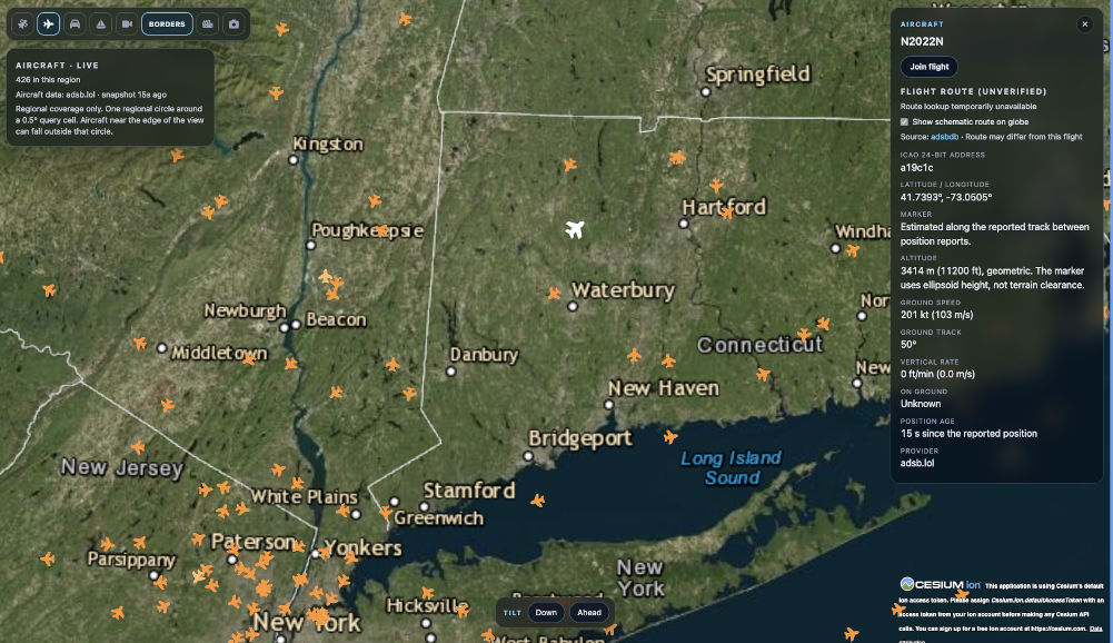
An interactive aircraft layer visualizing live flight data across geographic regions. Aircraft positions update dynamically, with selectable objects providing contextual flight information.
A Join Flight feature transitions the camera from an overhead map into the aircraft's perspective at altitude, creating an immersive experience that allows users to explore the surrounding geography as though viewing it from the aircraft.
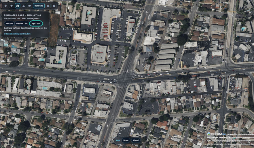
An experimental traffic visualization layer bringing overhead street maps to life through animated vehicle movement.
Cars are rendered at approximately real-world scale relative to the underlying imagery and follow mapped road networks, exploring how simulated movement can add activity and spatial context to otherwise static geographic views.
The experiment is actively being refined to improve vehicle positioning, route alignment, animation behavior, and visual realism.
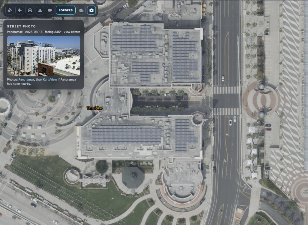
An experiment connecting overhead geographic imagery with community-contributed ground-level photographs using geographic location metadata.
When exploring a building or geographic location from above, nearby geotagged photographs can be discovered and displayed, revealing an additional perspective captured by a photographer on the ground.
This approach explores how crowdsourced imagery can complement satellite and aerial views, providing a richer understanding of physical locations without requiring a continuous street-view imagery service.
From Experimentation to Platform
These experiments are more than isolated visual demonstrations. Together, they explore the data integration, rendering techniques, and interaction patterns needed to support increasingly sophisticated geospatial applications.
Insights and validated capabilities from the lab will inform the continued development of Noah Link, including its planned satellite operations, ground infrastructure, and mission-planning interfaces.
Development Status: Active experimentation and prototyping.